Categories

Archives

North Precinct Advisory Council Minutes – April 2015

SPDbadgeThis month’s guest speaker was Pete Holmes, Seattle City Attorney. He explained the function of his office.

In precinct news, the SPD top level shake-ups have trickled down to the precincts. Our Captain Dave Emerick is being moved to Narcotics Unit. Our new captain will be Sean O’Donnell, a long-time officer at SPD.

Also discussed were the problems with dealing with car camping on public streets, where we are in regulating marijuana and more. Read the minutes here.

Save the Date – July 18 – for Pinehurstfest 2015

We’re working on this year’s summer social, Pinehurstfest. If you know a community organization that would like to have a table, please let us know – info@pinehurstseattle.org. Meanwhile, save the date!

2015Pinehurstfest

Kids’ Art in Pinehurst Pocket Park

Sotiros

April’s art in the park is by Sotiros, who drew it at last year’s Pinehurstfest. Is this a character in a cartoon? I’m not up to speed on kids’ shows. It sure adds a fun element to the park! Go see it in the kiosk at Pinehurst Pocket Park, NE 117th St and 19th Ave NE.

If you would like to submit your child’s artwork for the Pocket Park, please email nancy@pinehurstseattle.org. We’ll put it on mat board donated by FRAMEIT Ltd, 10712 5th Ave NE.

Art in Bloom Tour

ArtInBloomArt in Bloom, Seattle’s new garden art studio tour happens April 25-26 from 10 am to 5 pm, rain or shine. A group of north Seattle artists and their friends have put together a self-guided tour which gives visitors a chance see outdoor art in the artist’s own garden. And most of the art is for sale.

Each site is hosting several local artists with complementary work so there are artists from many media to talk with.

Get the map and details at ArtInBloomSeattle.com.

Thornton Creek Alliance Meeting 3/26/2015

TCA

Neighborhood Project Awards

NeighborAppreciationDayTwenty-nine community groups received awards in March 2015 from the Neighborhood Matching Fund(NMF) for projects as diverse as youth fitness programs to pop-up parks. Here are the ones nearest to us in Pinehurst:

$17,000 to Lake City Greenways Project to develop partial construction drawings for a new Olympic Hills pocket park. (Community match: $12,724)

$25,000 to North End Health & Human Service Providers Co-op to create the Lake City Summer of Fun, a way to engage low-income youth in creative and physical activities. (Community match: $135,215)

$10,515 to Friends of Jackson Park Trail to remove invasive species and restore native plants in riparian area and on slopes above Thornton Creek along Jackson Park Trail. (Community match: $10,320)

The Small and Simple Projects Fund opens again for applications in May and September. To learn more visit seattle.gov/neighborhoods/nmf/smallandsimple.htm.

EarthCorps Seeking Hosts for International Participants

EarthCorps is seeking hosts for our international participants for June 2015 – December 2015

Host an EC International - Family shot

EarthCorps brings young adults from around the world to Seattle for a six month environmental leadership program. Our participants are passionate, hardworking, and driven to solve climate change and water crises affecting our world. At EarthCorps they gain technical, hands on, experience as they work to improve Puget Sound parks, shorelines and salmon streams.

International participants are aged 22-26, proficient in English, and train full-time at EarthCorps. Host families play a vital role in our program and provide international participants a welcoming home and a window to Northwest culture. As a host family you will build a lifelong relationship with an inspiring young adult and be able contribute to protecting Puget Sound forests, all from the comfort of your home. Singles, couples and families with children are all welcome to host.

Host families are provided a $500 per month stipend to offset food and living expenses. Families are asked to provide a furnished bedroom for their International Participant and commit to hosting for a three month period, between June 2015 and December 2015. It is preferable for families to live in Northeast Seattle so participants remain close to EarthCorps’ Magnusson Park headquarters.

EarthCorps is committed to finding the right match for our homestay families and international participants. Do you have a strong interest in a particular country, language or culture? Let us know!

Start now to become a homestay family. Visit us at http://earthcorps.org/homestays.php. Our staff will be happy to answer all your questions to make sure the Homestay program is the right fit for you! You may also contact us by telephone, 206-322-9296 X 224 or by email, homestay@earthcorps.org.

Nathan Hale Urban Farm Party

organic-CSA-farm-vegetables4Please join us on March 29th to learn about the Nathan Hale Urban Farm, with a Permaculture Twist!   Please forward to whomever you think might want to participate.  Meeting and dinner are FREE.  We are looking for community involvement to create, install, maintain the urban farm, and mentor our youngsters in permaculture principles and practices.


NATHAN HALE URBAN FARM
EARLY SPRING NETWORKING AND PLANNING PARTY
MARCH 29, 2015, 4pm – 6pm


Dinner served!


Come see plans for the space around the greenhouse and learn how you can join the effort


Greenhouse north of Jane Adams Middle School
11051 34th Avenue, ne, seattle, 98125


Please RSVP by clicking on this link
https://docs.google.com/forms/d/1o4GDqsgBHHfLWvpWPO4rTCfEAj_ksQlov4GXMPFgoN8/edit#

Pinehurst Bus Suggestions for 2016 Re-Alignment

A Pinehurst neighbor, Ross B, also wrote an article on Seattle Transit Blog about suggestions for the Pinehurst bus route changes coming soon. Metro is proposing re-alignments when Link opens at the UW Stadium in 2016. While many of us are very supportive of creating frequent grid-based bus systems that makes use of the investments in Link Light Rail, the proposed plans seem to have forgotten Pinehurst entirely. They reduce access to both the University of Washington and Link Light Rail, forcing extra transfers for very short trips. Much of Pinehurst is nearly as dense as Northgate and deserves frequent all-day service. [EDIT: Fixed the Seattle Transit Blog link to go to the right article.]

Metro recently announced a couple of proposals for improving the bus routes in various parts of the city, once light rail serves Husky Stadium. The issue has been covered in a series of articles, including this one, covering the north end. Amongst the more controversial changes was one that would effect the Pinehurst area of Seattle.

Pinehurst is a somewhat obscure area between Lake City and Northgate. It doesn’t have a huge number of people, but has a fair number of apartments and is only a little less densely populated than Northgate (which you can see by zooming in on this census map). One of the nicer things about the area is that there are fairly regular buses from there to the U-District. Specifically, the 73 and 373 both connect Pinehurst with the UW.

This would change under alternative one. Service would be consolidated to a new route, the 67, which serves Roosevelt, then loops around to the Northgate Transit Center. While I see the need to serve Northgate from the south, I think there are several flaws with this suggestion:

  1. Except for the 373 (which runs infrequently and only during peak hours) bus riders in the area will no longer have direct service to the U-District.
  2. The transfer required to get from the 347/348 will be awkward.
  3. Metro will spend service hours sending a bus in a somewhat convoluted and congested route to Northgate.
  4. Riders trying to get to Northgate from the south will endure this somewhat convoluted route.

Most of these points deserve a little explanation. First of all, to get to the UW, a rider coming from Pinehurst or anywhere in the service area of the 347/348 would change buses at Roosevelt and Northgate Way. This is awkward mainly because the buses will be turning. For example, if you are headed north, you would stay on the 67 until it makes the left turn towards Northgate. Then you have to cross Roosevelt, to get to the bus stop (on Roosevelt heading north, north of Northgate Way). If the other bus (coming from Northgate) arrives before the light changes, you will miss it. First the bus will turn left, then you will be able to cross the street and get to the bus. Unless the bus driver is patient, and willing to delay everyone on the bus, you will have a fifteen minute wait for the next bus. At best you have to wait almost two complete light cycles to make this transfer.* At worst you miss the bus. This is a degradation not only for Pinehurst riders (who never had to make the transfer) but those who used to make a transfer from the 347 or 348 to the 73. Previously, those routes shared service on 15th Avenue NE, which meant that a rider simply had to get off the bus and get on a different bus at any of the bus stops. That will no longer be available.

Second, based on my calculations, the 67 route that loops around on Roosevelt is roughly 5.5 miles, versus a route that goes more directly, which is 4.4 miles. My guess is that the cost in time is even bigger, as the route will spend a significant amount of time making turns in heavy traffic. This means that service hours are being spent taking a less direct route, which not only effects those who will be delayed in connecting to Northgate, but the system in general.

There have been numerous suggestions and ideas for improving the situation. I suggest three here, to perhaps make it a bit easier for people to reference them if they want to contact Metro about these changes. I am calling the new bus route that replaces much of the old 73 the 63, to avoid confusion. Hopefully this will be clear by looking at the maps.

Suggestion One:

This map shows the route. As you can see, both buses would share service from the UW to the Roosevelt neighborhood. This is by far the most popular section, so sharing service would provide greater frequency for this important corridor. As with all of the suggestions I make, riders headed to Northgate will have a faster, more direct ride. This direct ride will save a significant amount of service hours, which means that, if my calculations are correct**, you could have the following:

New 67 (red on the map) — Every 12 minutes
New 63 (blue on the map) — Every 30 minutes

This is a very slight reduction in service for the 67 (10 minutes to 12 minutes) but a more direct route.

Suggestion two:

This is the same map, but with different scheduling. Essentially, the buses will simply trade-off, the way that the 347/348 trade-off. So, you have:

New 67 (red on the map) — Every 20 minutes
New 63 (blue on the map) — Every 20 minutes

This serves the core of the route (from the UW to the Roosevelt neighborhood) every ten minutes. Since both routes are likely to be shorter, this saves service hours over the routes designed by Metro in their Alternative One, which can then be used to bolster frequency anywhere in the system or makes these routes more reliable.

Suggestion Three:

This route is more like what currently exists. The biggest advantage to this routing is that the new 63 is faster. It also has additional coverage, because it goes on 15th, not Roosevelt. Since the split occurs earlier than the other suggestions, it don’t think it makes sense to try and give each run equal time. The timing on this is identical to suggestion one:

New 67 (red on the map) — Every 12 minutes
New 63 (blue on the map) — Every 30 minutes

My Pick

I prefer suggestion two. I think there will be enough ridership to justify splitting the run, especially as Link is added to the UW. That is greater frequency (for both sections) than exists now, while still maintaining excellent frequency on the most popular section (UW to Roosevelt). It also provides for a very nice connection between Pinehurst and Maple Leaf.

In general I like the changes proposed with alternative one. I think it represents a better overall network. With any one of these changes I think it would be even better.


Footnotes:

* Figuring out the traffic light cycle is a bit complicated. But if this intersection is like most intersections, the light cycle is basically: turn, forward, turn, forward. So basically:

Left turn from Roosevelt
Straight on Roosevelt
Left turn from Northgate Way
Straight on Northgate Way (repeat).

With that in mind, at best you have this, heading northbound:

Left turn from Roosevelt (with the 67 bus — then get off the bus)
Straight on Roosevelt
Left turn from Northgate Way
Straight on Northgate Way (walk across the street)
Left turn from Roosevelt
Straight on Roosevelt
Left turn from Northgate Way (347/348 bus makes this turn and picks up rider)

It’s not as bad southbound. You simply have to wait for the light to turn.

** The math for determining service hours is very rough. Going to the Northgate transit center via Roosevelt and Northgate Way is 5.5 miles, versus 4.4 miles if you go via 5th. So that makes the math relatively easy. Instead of 6 per hour (of the proposed 67s) you run 7.5 per hour. But you don’t. You take 2.5 runs and give it to the new 63. I round down (to be conservative) and that means two runs an hour on the new 63, and five runs an hour on the 67. That translates to a bus every 12 minutes for the new 67 (via 5th) and a bus every half hour for the new 63.

Bus Routes After Lynnwood Link / 130th St Station

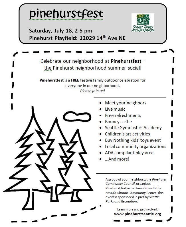
A Pinehurst neighbor, Ross B, wrote an article on Seattle Transit Blog about some possible bus routes for when we get a NE 130th St Light Rail Station. This would hopefully be opening at the same time as Lynnwood Link (2023) and would help create better connections to the whole Link system as well as let us design some better East-West connections for Pinehurst and the north end. This is based on some previous work by David Lawson. There is a Google Map you can look at but the route by route analysis is also fun for the wonky ones out there. This is just one idea but I think it’s important to start looking at it now. And it’s exciting to see how great things could be. I’ve included the full post here with permission.

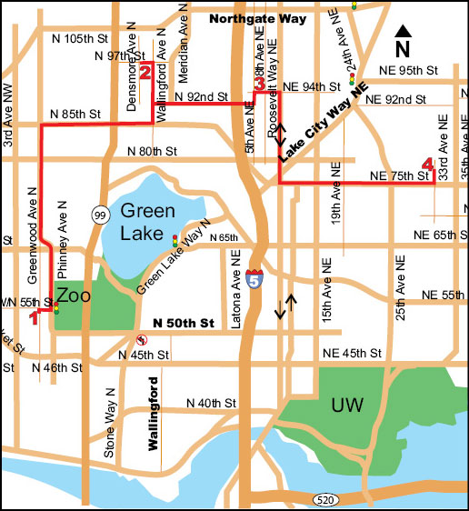
I thought it might be interesting to see what bus routes in the north end would look like, if a station was added at NE 130th. So, I decided to sketch out a proposal.

Map Notes

I used Google Maps to create a route map for parts of the north end. This was a bit of a challenge. There are several advantages of using Google Maps (you can zoom in and out easily, hide various features, choose between different background maps, etc.) but this did require me to manually draw the bus routes. Since I have trouble coloring between the lines, I took a few short cuts. First off, I ignored one-way streets. So, for example, a bus route that follows Roosevelt is drawn only on Roosevelt, even though the bus will have to go on 12th heading north.

I based my routes off of the maps that David Lawson designed. I don’t think I would have attempted this, if not for his excellent work. If I list a route as being the same as one that he designed, and there is a difference, the difference is accidental. I got lazy, and left many bus routes off. I focused on the north end routes,  so routes that didn’t go north of the new 71 are left out. The only bus routes that do go north of the new 71 that I didn’t draw are the Rapid Ride D, the 15 and the 28. I would use David’s maps as a guide to see how this fits into the bigger picture.

There are three layers to the map that can be shown or hidden independently. The one titled “Bus Routes” is essential. You may find “Labels” helpful, depending on the zoom level. I find it helpful to show the light rail stops (I only list the ones north of the canal and south of Snohomish County). If anyone has any tips for displaying the information better, or know of tools that they think might be easier to use, please mention it in the comments.

Bus Route Notes

I think you will find a heavy dependence on Link. Almost every bus in the area goes close to a station. Even with the heavy dependence on Link, and the occasional detour, it still provides a much needed grid to the north end. There are individual buses going directly east and west on 125th/130th and 145th. On Northgate, the bus makes a bit of detour, as do the buses on 155th and 175th.

I didn’t attempt to estimate frequency levels, but with the exception of the 71 and the new 41, I think fifteen minutes for just about every line is reasonable. David has that for most of the north end as well. Some of these will likely have twenty or thirty minute frequency, but very few. The new 41 (as I am calling it) will hopefully be at least as frequent as the new 71 (ten minutes).

As should be obvious, the new 41 is a key bus route in this system. I feel it is very important to have fast, frequent service from Lake City Way to Greenwood Avenue along 125th/130th, but by no means is this the only way to achieve this. Sound Transit and Metro run lots of buses along highway 522. Much of that is on bus lanes, which make it a prime candidate for BRT. If BRT could be built along here, and the buses deliver fast, reliable and frequent service, then the 522 (or something similar) could replace the 41. But I drew the 41 assuming that wouldn’t be the case, and that Sound Transit’s 522, for example, would end before Bitter Lake.

So, with all that in mind, here are the bus routes:

Bus Routes

5, 16, 65, 71, 88 — The same routes that David Lawson designed.

40 — This is the same route as David Lawson designed it, but with a small change. I extended it to 145th, instead of the old turnaround for the 41 (more about that below).

41 — This is the key bus route in the area, and why I started this project. Not only does it connect Lake City and Bitter Lake with Link better than the alternatives, but it connects the east and west side of north Seattle extremely well. 125th/130th is simply the best way to cross the freeway, between 85th and 145th. It is straight, fast, goes right by a station and is not as congested as alternatives. The fast connections enabled by this bus are substantial, connecting neighborhoods via buses that travel fast and (sometimes) frequent corridors such as Greenwood, Aurora, Ravenna Avenue NE (not to be confused with Ravenna Boulevard), 35th NE and Sand Point Way. For example, the following connections are fastest using this bus:

  • Lake City to 105th and Aurora
  • Jackson Park to 115th and Greenwood
  • Lake City to Woodland Park Zoo
  • Shoreline to Wedgewood
  • Mountlake Terrace to Matthews Beach
  • Lynnwood to 95th and Aurora

If RapidRide improves, this might even be the best way to get to the north end of Fremont (45th and Aurora) from Snohomish County and Lake City. This is because the new 41 could provide the best connection from Link to Aurora. North of there (145th) means more time spent on Aurora (and less on Link). South of there means time spent backtracking or dealing with bad traffic. Providing the first good connection between the east and west side of Seattle north of 85th means that it will provide the type of transit network that this city has never had. Many of these trips will obviously be in high demand (Lake City or Bitter Lake to the UW or downtown) while others might seem rare (Lynnwood to 95th and Aurora). But these are the types of trips that force people into their cars. Or, to put it another way, service like this can get people out of their cars.

Deciding where to end this new 41 on Lake City Way is not easy. I decided to extend it past the old 41. I have trouble leaving out the very densely populated area between there and 145th.. Folks there could walk (of course) but the logical end of this run is 145th (after which, the population decreases rapidly). Turning around is problematic, but I figured one left turn (at 145th) and a series of right turns would be fairly easy. If this doesn’t work, then this (along with the 40) could end where the old 41 ends.

67 — This is very similar to the 67 that David Lawson designed. It travels up University Way and 15th (instead of Roosevelt) before cutting over to 5th. The interplay between the 67 and 73 is interesting, and can be done any number of ways. In this case they compliment each other in coverage, and only overlap south of 45th. Even that could be eliminated, by making one of them stop there (or at Roosevelt, although that would lose some coverage).

69 — This is similar to the 69 David Lawson designed. South of NE 125th (the Lake City neighborhood) it is exactly the same. But this heads west at NE 145, then north up to Aurora Village via Meridian.

73 — This is a new 73 that follows Roosevelt for much of its route. With the old 41 route gone, there will no longer be service on 5th Ave NE, north of Northgate Way. This will follow Roosevelt, and thus replace it. There will be just as much coverage, and a shorter walk for the majority of riders (since there are more apartments on Roosevelt).

75 — This is the new 75, which follows the old 75 route, south of 125th NE (the Lake City neighborhood). North of there it makes its way over to 130th, then heads over to Shoreline College.

78 — This is very similar to the 78 David Lawson designed. The only difference is that it connects with the station at 145th.

81 — This is similar to the 81 that David Lawson designed. The only difference is that it makes a detour to the Mountlake Terrace Transit Center. I’m not thrilled with the way it does this, but I think it is important that a bus like this directly connect with Link (one way or another).

87 — This is similar to the 87 that David Lawson designed. North of 145, it is the same. At 145th, it crosses the freeway, and serves Meridian.

89 — This serves Kenmore, the 522 corridor, and 145th. This creates a one stop connection from Greenwood Avenue to Lake City Way (including Link) to compliment the 41, which provides the same on 125th.

Doubling Up

There are several areas where bus routes merge. It may be difficult to see from the map. So here is a list of some of the more important ones:

Northgate Transit Center to Northgate Way and Roosevelt — 40 and 88.

Lake City Way, between 125th and 145th — 40, 41 and 69

NE 125th and Lake City Way to Meridian and 130th — 41 and 75

NE 145th, between 30th Ave. NE and Meridian — 69, 78, 89

Conclusion

There are a lot of different ways these routes can be designed. By no means do I think I have the best solution. I’ve done some hand waving as far as where to send buses on highway 522, but I am convinced that fast, frequent service between Lake City Way and Bitter Lake is essential and possible, while still providing excellent service for 145th.