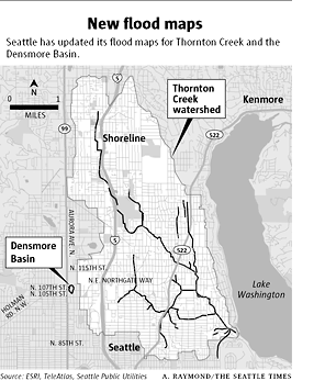
The Seattle Times and Seattlepi.com have articles today about the updating of maps for flood-prone areas in Seattle. Seattle Public Utilities has added some and removed other areas in the Thornton Creek watershed area that are prone to flooding. The map below here shows the watershed area, but not the specific areas that are being designated at flood-prone.
The map below here (from Seattlepi.com and taken from Seattle City records) shows designated flood-prone areas. Some of these areas are in Pinehurst.
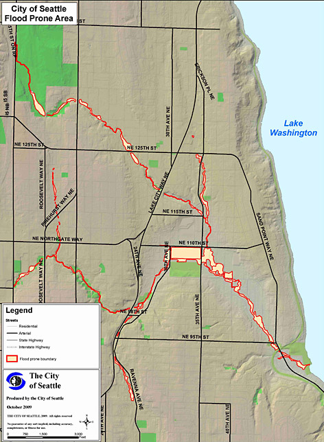

This is the direct link to the map, for those of you that want to zoom in on your property:
http://www.seattle.gov/util/stellent/groups/public/@spu/@ssw/documents/webcontent/spu02_019868.pdf
Also, reminder about the Orientation Meeting Thursday October 15th 6pm-9pm at North Seattle Community College for those of you that live along the creek or its tributaries and want information on the new map…you should have received a letter in the (regular) mail with the invite and a copy of the map…